Final Minutes Before Disaster: How Floodwater Overwhelmed the Nepal-China Border

Immigration records, CCTV footage and survivor accounts are helping investigators piece together the last moments before a devastating flash flood tore through the Rasuwagadhi-Gyirong crossing.
A catastrophic flash flood that tore through the Nepal-China border on 26 August has left a trail of destruction so severe that investigators are still trying to reconstruct exactly what happened in the minutes before disaster struck. The flood destroyed the Friendship Bridge and the surrounding immigration and customs complex at Rasuwagadhi in Nepal, and caused equally severe devastation just across the frontier at Gyirong in China’s Tibet region.
Emerging details, including immigration records and CCTV timestamps, show how little warning people at the crossing had before the water arrived — and how quickly the border post was overwhelmed.
WHAT HAPPENED?
The disaster struck in the morning of 26 August, with officials citing roughly 8:40am local time as when the flooding began in earnest around Rasuwagadhi, Timure and Syabrubesi. According to reporting on the sequence of events, an ice and rock avalanche is believed to have blocked a tributary stream near the border, forming a temporary natural dam. When that blockage gave way, it sent a torrent of water, mud and debris surging down the Trishuli valley.
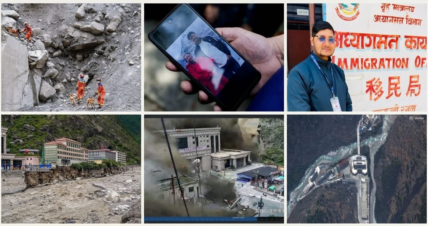
On the Chinese side, authorities said the mudslide took only about seven minutes to travel from where it originated to the Gyirong border crossing. Immigration records from the Nepali side show the system logged its final entry at 8:35:03am local time — under ten minutes before surveillance cameras at Gyirong captured the floodwaters arriving.
The border complex at that hour was unusually crowded. Ghatte Khola, the area functioning as a waiting zone near the crossing, was described as home to roughly 50 to 60 houses along with hotels, shops and four hydropower company offices. It also served as the final stop for buses arriving from Kathmandu and as a base for drivers, porters, tourist guides and cargo workers waiting on customs clearance, with travellers bound for Tibet often having queued there since the previous day.
Within minutes, much of that infrastructure was gone. The Friendship Bridge linking Nepal and China was swept away, along with Nepal’s immigration and customs buildings. The small trading settlement of Timure was largely destroyed, and satellite and aerial imagery later showed the Gyirong checkpoint on the Chinese side reduced to rubble and mud, with little recognisable when compared to earlier images of the same site.
WHAT OFFICIALS / SOURCES ARE SAYING
Officials in Nepal confirmed that four immigration staff at the Rasuwagadhi office, including the head of the office, were reported missing after the flood; the body of the office chief was later recovered far downstream. A female official believed to have logged the crossing’s final recorded transactions remained unaccounted for. Tika Ram Pokharel, a senior immigration assistant at the office, was reported to be the only staff member confirmed to have survived — he had been in Kathmandu that day for an examination.
Chinese authorities, cited by state broadcaster CCTV, said engineers were monitoring a lake that had formed behind a natural dam created by the landslide, warning of a “high risk” that it could breach and cause further flooding downstream, including at the Gyirong crossing. China’s National Fire and Rescue Administration said it had deployed hundreds of firefighters, rescue dogs, vehicles and drones to the area in the days after the flood.
Britain’s King Charles III said in a message that he was “heartbroken” by the disaster, reflecting the presence of British nationals among those affected.
KEY FACTS
- Location: Rasuwagadhi (Nepal) and Gyirong (China’s Tibet Autonomous Region), on the Nepal-China border
- Date: Flooding began around 8:40am local time on 26 August 2026
- Cause reported: A landslide-triggered natural dam-burst sending a torrent down the Trishuli valley; geomorphologists have also pointed to a possible glacier collapse
- Infrastructure destroyed: The Friendship Bridge, Nepal’s immigration and customs complex, hydropower facilities, and much of the Timure trading settlement
- People affected: Officials have reported well over 150 deaths and, according to later figures, more than 1,000 people unaccounted for across both sides of the border
- Official response: China has deployed hundreds of rescue personnel, dogs, vehicles and drones; hundreds of stranded tourists and villagers have been relocated or evacuated
- Latest development: Chinese authorities are warning of a continued risk that a landslide-formed lake near Gyirong could breach and cause further flooding
WHY THIS MATTERS
The disaster has disrupted a major overland trade and travel corridor between Nepal and China, halting cross-border commerce that normally moves through the Rasuwagadhi-Gyirong route. With the bridge destroyed, goods must now take a longer alternative path via India. The human toll has also drawn international attention, with foreign nationals — including Indian, Chinese, American, British, Canadian, Australian and Italian citizens recorded as having crossed the border that morning — among the missing.
The event has renewed scrutiny of flood-warning systems in the Himalayas, where glacial and landslide-related flooding can strike with almost no notice, and has raised fresh concerns about the safety of settlements and border infrastructure built close to fast-moving mountain rivers.
BACKGROUND
The Rasuwagadhi-Gyirong crossing is one of the principal official border points between Nepal and China’s Tibet region, handling both bilateral trade and cross-border travel. The area lies in mountainous, glacier-fed terrain that has experienced flooding linked to glacial lake instability in the past. Nepal’s monsoon season, which typically runs from June to September, regularly brings heightened flood risk to the country’s river valleys, though officials investigating this event have pointed to a landslide-triggered dam failure — rather than monsoon rainfall alone — as the immediate trigger.
WHAT HAPPENS NEXT?
Chinese authorities say they are continuing to monitor the landslide-formed lake near Gyirong for signs of a potential breach, and have restricted access to parts of the border area as a precaution. Search and rescue operations are continuing on both sides of the frontier, with helicopters, ground teams and rescue dogs deployed to reach areas still cut off by damaged roads. Investigators are expected to continue reconstructing the sequence of events using CCTV footage, satellite imagery and immigration records as recovery efforts proceed.
LATEST UPDATE
The situation remains under close watch. Chinese officials have warned that continued inflows into the dammed lake near Gyirong could raise the risk of a further breach in the coming days, and rescue operations are ongoing as authorities continue working to confirm the full scale of casualties and those still missing.